They know where the elephants are—down to the minute. In Zimbabwe’s wild heartlands, elephants have become accidental trespassers. Herds searching for food and water often wander too close to villages, triggering chaos, fear, and sometimes tragedy. Now, with GPS collars blinking on satellite maps, the game is changing. Each collar tracks a matriarch—the leader of her herd. When she moves, rangers know. If she heads toward crops or communities, a warning pings. People prepare. Conflict is avoided. It’s a high-tech lifeline in a land overflowing with giants. In this dusty corner of Africa, GPS isn’t just for directions. It’s keeping peace between humans and some of the most powerful animals on Earth.
Introduction of GPS Collars
In a landmark move for wildlife conservation, GPS collars have been fitted to African savannah elephants near Zimbabwe’s Hwange National Park. These collars, linked to Earth Ranger technology, provide real-time tracking, offering a glimpse into the elephants’ daily lives and migration patterns. The project, a collaboration between IFAW and ZimParks, focuses on reducing human-elephant conflict by monitoring elephant movements and interactions. The technology allows conservationists to respond swiftly to potential threats or conflicts, ensuring both human and elephant safety. This innovative approach heralds a new era in wildlife management.
Earth Ranger Technology
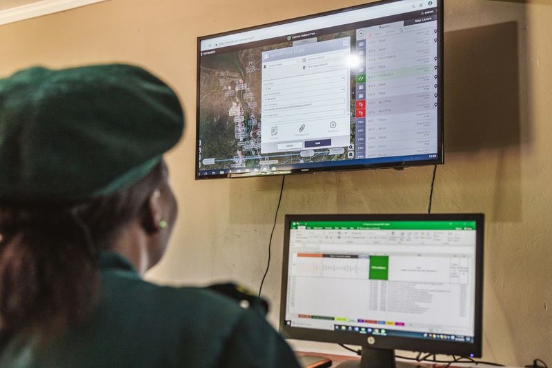
At the heart of elephant tracking lies the Earth Ranger technology. This sophisticated system collects and analyzes data from GPS collars, offering insights into elephant behavior and habitat use. Earth Ranger’s real-time alerts enable rangers to prevent human-elephant conflicts efficiently. The technology also supports data-driven decision-making in conservation strategies. By leveraging this cutting-edge technology, conservationists aim to enhance the coexistence between humans and elephants. The platform also aids in understanding the broader ecological dynamics within the Hwange-Matetsi-Zambezi landscape, fostering informed conservation efforts.
Collaring Operation
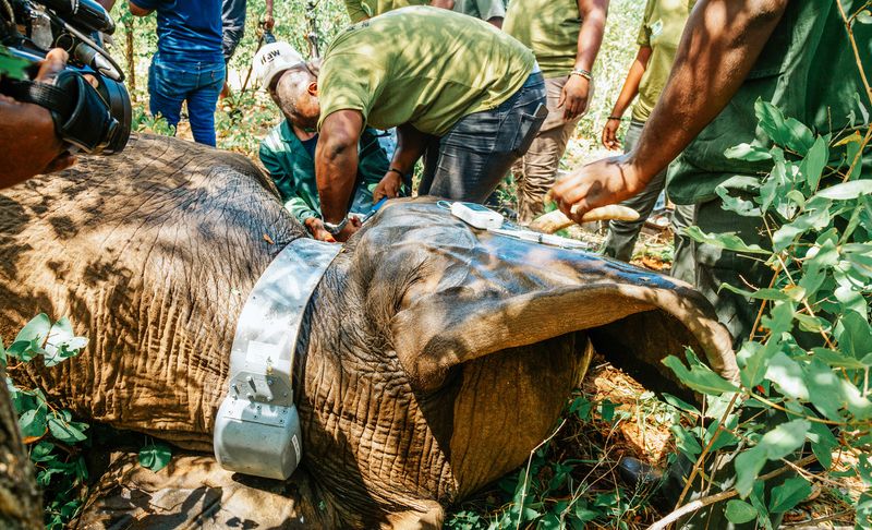
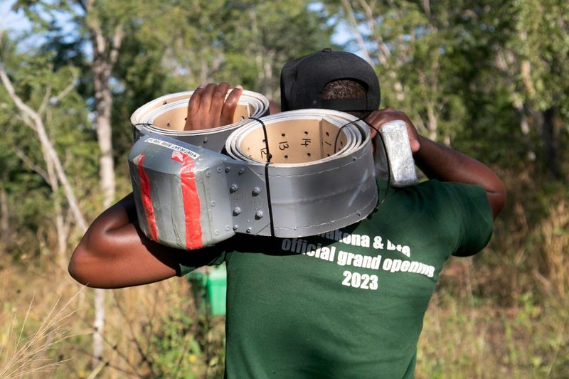
The collaring operation in Hwange was a meticulous effort involving skilled wildlife experts. Conducted over ten days, the operation aimed to enhance understanding of elephant ecology and reduce human-wildlife conflict. Teams from IFAW and ZimParks collaborated to safely fit the collars, ensuring minimal stress to the elephants. This initiative is part of a broader strategy to use technology in conservation, providing crucial data on elephant herds. The operation highlights the commitment to preserving Zimbabwe’s rich biodiversity by integrating modern science with traditional conservation practices.
Impact on Human-Elephant Conflict
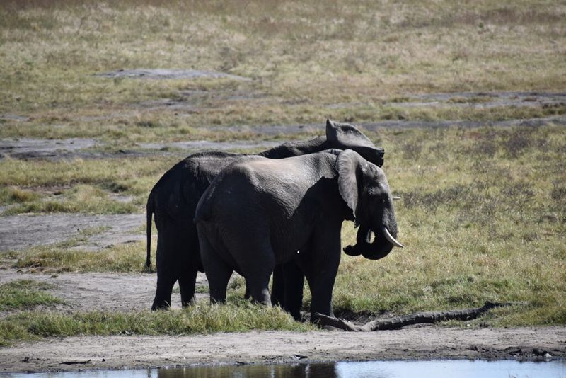
As elephants traverse areas near human settlements, conflicts often arise. GPS collars offer a solution by tracking elephant movements and providing real-time data to rangers. This information allows for proactive measures in mitigating conflicts, enhancing safety for both humans and elephants. The data also aids in understanding elephant behavior patterns, enabling targeted conservation efforts. By reducing conflicts, the initiative supports harmonious coexistence and fosters community engagement in wildlife conservation. This strategy emphasizes the importance of technology in addressing conservation challenges effectively.
Hwange-Matetsi-Zambezi Landscape

The vast Hwange-Matetsi-Zambezi landscape serves as a critical habitat for elephants and other wildlife. Spanning over 14,600 km², this region forms a vital corridor for wildlife migration. The GPS collar initiative is crucial in monitoring elephant interactions within this expansive landscape. By understanding their movements, conservationists can implement strategies to protect critical habitats and migration routes. The project also highlights the landscape’s ecological significance, promoting efforts to maintain biodiversity and sustain wildlife populations. This approach underscores a commitment to conserving Zimbabwe’s natural heritage.
Room to Roam Initiative

The Room to Roam initiative, spearheaded by IFAW, aims to reconnect fragmented habitats for wildlife. This ambitious program focuses on creating corridors that allow elephants and other species to move freely across landscapes. By utilizing data from GPS collars, conservationists identify key areas requiring protection and intervention. The initiative supports efforts to mitigate human-wildlife conflict and ensure sustainable habitat use. This visionary project emphasizes the importance of connectivity in conservation, promoting a future where wildlife can thrive in their natural environments. The initiative is pivotal in shaping conservation strategies in Zimbabwe.
Future Challenges and Prospects
Looking ahead, the completion of the Gwayi-Shangani Dam presents new challenges for elephant conservation. The dam’s presence is expected to alter elephant routes, necessitating adaptive conservation strategies. GPS collar data will be invaluable in understanding these changes and guiding interventions. Conservationists anticipate that the reservoir will influence elephant distribution, requiring a reassessment of current strategies. Despite challenges, there is optimism for using technology to address emerging conservation issues. This proactive approach highlights the evolving relationship between humans and wildlife, aiming for a sustainable coexistence.